Journal
Our Guide To The Yorkshire Wolds Way
Fancy a two-footed adventure? Explore the rural delights of gods own country with a stroll along The Yorkshire Wolds Way.
The Yorkshire Wolds Way
Is the rambler in you looking for the next walking holiday adventure? May we highly recommend the Yorkshire Wolds Way. While North Yorkshire is famous for The Cleveland Way, the East Riding of Yorkshire also has an excellent route for fans of the footpath.
Starting in the Humber Estuary and ending in Filey on the coast, the Yorkshire Wolds Way walk takes in lush countryside, ancient monuments and stunning views.
Continue reading to explore everything you need to know about this wonderful walk…
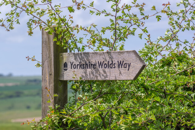
The Yorkshire Wolds Way National Trail
The Yorkshire Wolds Way is a national trail walking route that winds for almost 80 miles through East Yorkshire. While popular, it’s a little quieter and more relaxed than other major national trails in England, offering walkers peace and tranquillity amongst the countryside.
How long does it take to walk the Yorkshire Wolds Way?
The trail totals 79 miles, with most guidebooks recommending you walk the trail in five or six days. Of course, you could take longer to truly savour the countryside, or shorter if you’re pushed for time.
Many people prefer to complete a specific section as day walk rather than completing the whole route.
The Yorkshire Wolds Way and The Cleveland Way
The Yorkshire Wolds Way begins in the Humber Estuary and travels through East Yorkshire. Another major national trail, The Cleveland Way, starts in the North York Moors National Park.
For a change of scenery, this route includes a range of North Yorkshire coastal walks. Both routes end at Filey, with some walkers completing them back-to-back.
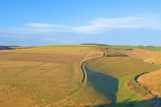
The Yorkshire Wolds Way Route
So, let’s look at the route. We’ll explain the major landmarks – however, we’d always recommend taking a Yorkshire Wolds Way map with you. The trail is also well-signposted and straightforward to follow.
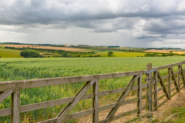
The route itself is pretty easy-going, with no significant ascents on the way. The trail is also open year-round, with many choosing the hike between April and September for the pleasant weather and blooming plant life.
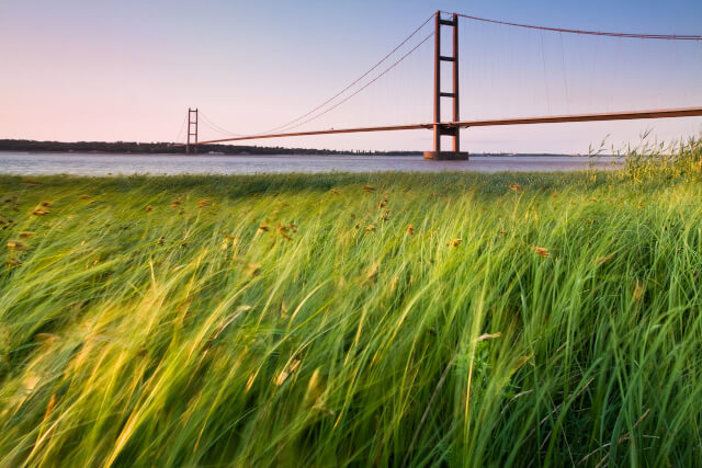
Hessle Haven or Humber Bridge to South Cave
The first stretch of the Yorkshire Wolds Way takes you 13 miles from Hessle Haven to South Cave. Many walkers also start the walk from the mighty Humber Bridge near Hull. Either way, you’ll begin your journey spotting ships in the Humber estuary before heading inland.
Once you’ve left the estuary behind, you will visit the village of Welton and head into beautiful woodland. Then, you’ll end the first section of your Yorkshire Wolds Way walk in a gorgeous little village: South Cave.
There are plenty of pubs, restaurants and shops here to refuel for the stages ahead. If you’re on a day trip, you can also catch public transport back to Yorkshire’s major towns and cities from here.
South Cave to Market Weighton or Goodmanham
Next, you’ve got a 12-mile hike from South Cave to either Market Weighton or Goodmanham. The walk splits in two briefly along this stage, meaning you’ll have to choose which path to follow.
Before the fork, you’ll visit some peaceful villages and intriguing monuments. Leaving South Cave, you’ll follow the path to Weedley Dale, climbing up to a peak with fantastic views over the Wolds and Humber estuary. Once over, you’ll head into the dry valleys of Swin Dale and Spring Dale.
In Spring Dale, you’ll choose to head to Goodmanham or Market Weighton. Railway fans might choose the Market Weighton line to visit the George Hudson line from Beverley to Market Weighton.
Nature fans can head to Goodmanham to see the Rifle Butts Quarry wildlife reserve. Both are worth a visit and have pubs and shops, so choose based on your personal interests.
Market Weighton or Goodmanham to Millington
The next stage is a shorter one, taking just 8.5 miles. You’ll leave either Market Weighton or Goodmanham and take in the gorgeous Londesborough Park. You’ll then head back into the countryside – this stage is perfect for nature fans and bird watchers.
Through the green Yorkshire countryside, you’ll head north towards Pocklington through Warren Dale. Get your binoculars ready to spot sights like the White Horse of Kilburn on a clear day. You’ll then stop for a break in Millington, a typical East Riding of Yorkshire village.
Millington to Thixendale
The next day, you’ll head out of Millington towards Thixendale. This 12-mile stretch has some relatively steep climbs, so make sure you have a hearty breakfast first.
At some points on this route, you might be able to spot many landmarks in the distance – from York Minster to the west to the Humber Bridge in the south. You’ll pass through the village of Fridaythorpe – where many stop for lunch – and head onto Thixendale village. Here, there is a good selection of shops and pubs ready for refreshments.
Thixendale to Sherburn
The longest stage of the Yorkshire Wolds Way – at 19 miles long – takes you from Thixendale to Sherburn. This section also takes you to the highest points on the Way, at around 700 feet.
Leave Thixendale village, climbing to the highest point. Then, you’ll descend into Deepdale. Along the route, you’ll visit the fascinating deserted medieval village of Wharram Percy, abandoned in the 15th century. There are clues here that tell of the village’s iron age past, as well as some ancient church ruins.
Next, you’ll head to Wintringham and change direction to head east into the Vale of Pickering, with amazing views of the North York Moors beyond.
Eventually, you’ll arrive at the village of Sherburn for a well-earned break. From Sherburn, you can take public transport to Leeds, York and Scarborough, or head on to finish in Filey.
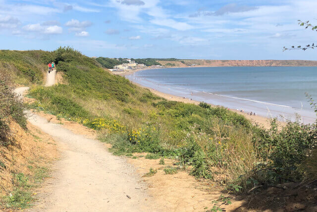
Sherburn to Filey
Ready for the last leg? The final stage takes you from Sherburn all the way to the coast at Filey on a 17-mile journey. First, you’ll follow the sloping escarpment heading towards Ganton, taking in your last section of the lush Wolds countryside.
Once you’ve reached Muston, you’ve officially left the Wolds, heading towards the end of the trail. As you enter Filey, you’ll eventually come to a National Trail sculpture (look for the infamous acorn carving) that marks the end point of the Yorkshire Wolds Way. You might meet other travellers coming from the north – this location also marks the end of The Cleveland Way and some of North Yorkshire’s best walks.
Congratulations, you’ve completed the Yorkshire Wolds Way walk. From here, you can have a relaxing break in Filey, walk up the Filey Brigg peninsula, or take public transport to any of Yorkshire’s major destinations.
Does an adventure along the Yorkshire Wolds Way sound like your kind of walking holiday? Then let’s get started.
Browse our handpicked selection of Yorkshire cottages to secure your Yorkshire Wolds Way accommodation today.
And for more ways to discover the countys natural beauty, give our guide on the most beautiful places in Yorkshire a read.