Journal
Your Guide To Walking The Cleveland Way
Taking in the natural beauty of both the coast and country of North Yorkshire, it's easy to see why The Cleveland Way is such a popular walking route.
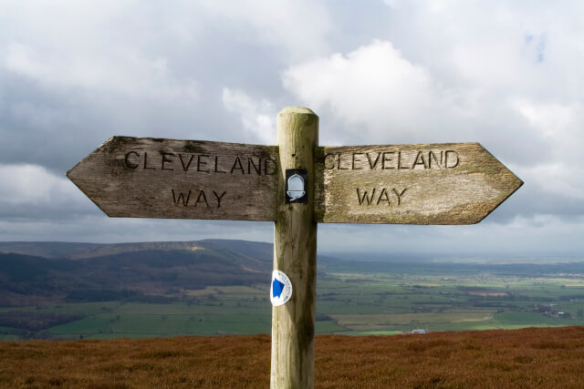
Walking The Cleveland Way
The Cleveland Way is a long-distance national trail walking route that takes in the very best sights and sounds of Yorkshire. From the rolling heather moorland of the North York Moors National Park to the dramatic North Sea coastline, walking the Cleveland Way provides memories that will last a lifetime.
Along the route, you’ll take in quaint market towns, stunning hamlets and lively fishing villages – as well as popular seaside towns like Scarborough and Whitby. Whether you’re planning a walking holiday or a day walk, we’ve got all the information you’ll need.
The Cleveland Way
The Cleveland Way National Trail runs for 109 miles through Yorkshire’s finest scenery. It’s one of the most beautiful national trails in England and Wales, sharing some of North Yorkshire’s best walking routes with the Yorkshire Wolds Way and the coast-to-coast Pennine Way.
Although the route can be challenging in places, walking the Cleveland Way only requires reasonable levels of fitness – there are no dramatic mountainsides or scary climbs. Sturdy boots are a must, though – especially on some of the coastal sections, and you should bring clothes to suit all weather, no matter the time of year.
An up-to-date navigation method is a must. You can find The Cleveland Way map along with the most up-to-date information here. We’d recommend aquiring a public transport timetable ahead of your adventure, just in case you’re caught short!
How Long Does it Take to Walk the Cleveland Way?
Walking the entirety of the Cleveland Way can typically take around nine or ten days. While many choose to complete the whole thing, other adventurers treat sections of the route as a day trip. There’s plenty to see along the way, so whether you complete the trail or explore short distances, you’re sure to be in for a treat!
We recommend taking a guidebook to ensure you don’t miss anything on your North Yorkshire walking holiday.
The Cleveland Way Walking Route
Helmsley to Sutton Bank
This 10-mile journey typically begins at the market town of Helmsley. Starting at this end of the route and working clockwise usually means that the wind will be at your back during the coastal stage.
On the first leg, you’ll leave Helmsley and wander the stunning Rye Valley. Along the route, you’ll see Helmsley Castle and Rievaulx Abbey set amongst the gorgeous woodland.
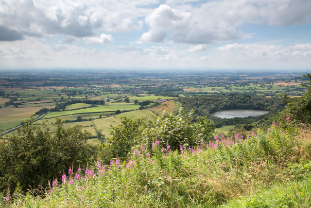
You’ll eventually reach the Hambleton Hills escarpment at Sutton Bank – with the legendary White Horse of Kilburn looming on the hillside. Sutton Bank visitor centre is a welcome stop for refreshments and more Cleveland Way information.
Sutton Bank to Osmotherley
Next, you’ll leave Sutton Bank on an 11-mile stretch towards Osmotherley. This is a well-trodden path, with traders and travellers following the route for many centuries. Along the way, you’ll see some stunning North York Moors National Park scenery, with cafes, shops and restaurants waiting in the village of Osmotherley.
Osmotherley to Clay Bank
Leaving Osmotherley, you’ll complete another 11-mile route through the stunning Cleveland Hills. The dales will be in full bloom for you as you wander through the countryside north towards Teesside. Along the way, you’ll cover five individual moors, before reaching a stopping point at Clay Bank.
Clay Bank to Kildale
A shorter 9-mile stretch, Clay Bank to Kildale offers more stunning moorland scenery. You’ll climb Urra Moor towards the highest point in the moors, before heading towards the village of Kildale. Here, you’ll find cafes, refreshments and rail connections heading to major Yorkshire towns and cities. This is a very popular stretch for day walks, mountain biking and dog walking.
Kildale to Saltburn
Next, you’ll turn towards the coast on a 15-mile hike. Once out of Kildale, you’ll follow the path over the Esk Valley railway line, part of North Yorkshire famous railway heritage. There are pubs and cafes in hamlets dotted along the route, before you reach Guisborough and Saltburn Woods. Make sure to take in the Captain Cook monument along the way.
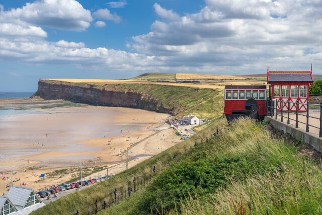
Leaving the forest, you’ll smell the salt in the air as the sea comes into view, eventually leading to the Victorian coastal town of Saltburn-by-the-sea.
Saltburn to Sandsend
Congratulations, you’ve reached the fabulous North Yorkshire coastline. From here on, you’ll continue your journey along clifftops and beaches as you head south on the heritage coast.
As you leave Saltburn behind on this 17.5-mile stretch, you’ll take in Boulby Cliff, the highest cliff on the east coast – it rises over 200 metres above the North Sea. Then, you’ll descend into Staithes, a stunning coastal village that was once home to Captain Cook. Consider stopping here for bustling pubs and restaurants.
Next, you’ll visit the picturesque Runswick Bay and Kettleness, before coming to a stop in Sandsend.
Sandsend to Robin Hood’s Bay
The next 10-mile route takes you from Sandsend to Robin Hood’s Bay, via the ever-popular seaside town of Whitby. You might make a stop in Whitby to learn about its incredible history (from Captain Cook to Dracula) or take in one of our walks in Whitby that visit Whitby Abbey on the clifftop.
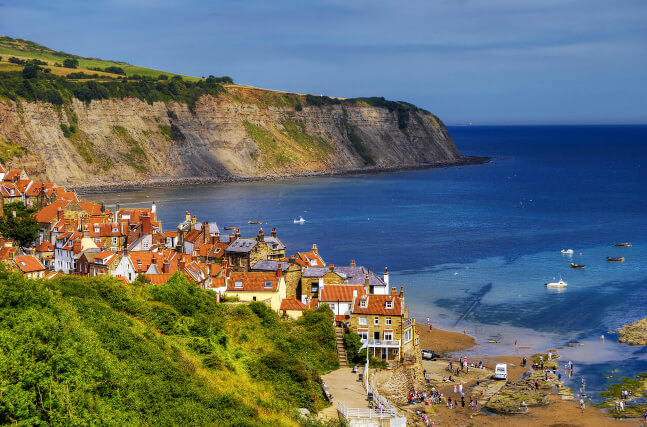
Leaving Whitby, you’ll make the final stretch of coastal walk towards the beautiful smuggler’s village of Robin Hood’s Bay. The Whitby to Robin Hood’s bay walk is one of the most dramatic and stunning examples of the Yorkshire coast, with sloping streets, cosy restaurants and lively inns to welcome you.
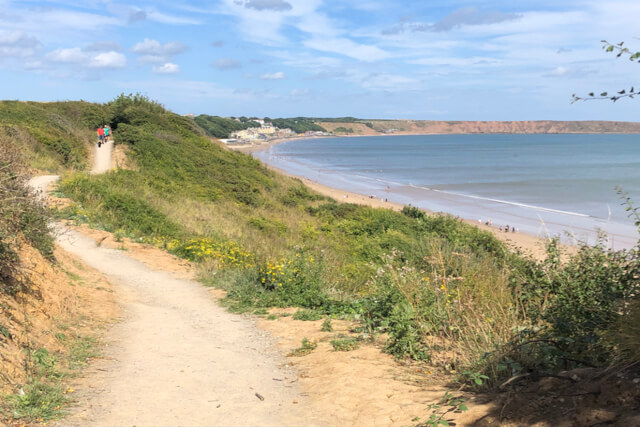
Robin Hood’s Bay to Scarborough
From Robin Hood’s Bay, you’ll begin the 12-mile stretch towards Scarborough. Along the way, you’ll pass the seaside town of Ravenscar, with its stunning views out over the North Sea. There’s also Hayburn Wyke, Boggle Hole and Stoupe Beck, so remember your camera.
Soon, Scarborough Castle will start to loom on the clifftops in front. Keep following the path and you’ll arrive at the quieter North Bay beach. From here, head around the headland to South Bay for a classic British seaside resort. You’ll find everything from fish and chips to arcades in Scarborough, making for the perfect stopping point before the final leg of your journey.
Scarborough to Filey
Finally, you’ll make the 10-mile trip from Scarborough to Filey. Along the way, you’ll see the beautiful Cayton Bay and its rocky outcrops, taking you all the way to Filey Brigg.
This marks the end of your trip through Yorkshire – from your beginnings in the moorlands to the stunning stretch of Filey beach. Why not head to Filey’s pubs and restaurants for a well-earned break.
Tempted to take on the Cleveland Way? Visit our wonderful selection of Yorkshire holiday cottages and start planning your next walking holiday.
With accommodation scattered along the 109-mile route, we’ve got everything you need to take on one of Britain’s most beautiful walks. And there’s plenty more sights to see with our guide to The Yorkshire Wolds Way.
And for inspiration on how to spend your time on the final leg of your journey, give our guide on the top 7 things to do in Filey a read!